Tarras is a thriving and productive farming, horticulture and viticulture area. It is one of the driest areas in New Zealand, with annual rainfall of between 300 and 500 millimetres. It spans the world in its reach with merino wool, award winning pinot noir wines and striking landscapes.
The Lindis area was the site of the first gold rush in Otago when gold was found in the Lindis River in 1857. A second gold era may be imminent, with sample drilling in the Bendigo hills showing potential for considerable returns.
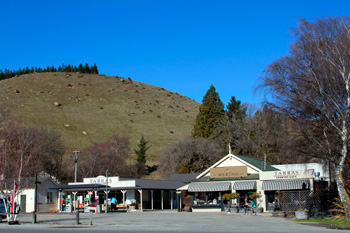
Situated on State Highway 8, Tarras Village is less than 30 minutes drive from both Cromwell and Wanaka and 60 minutes to Queenstown.
To the north lies the Lindis Pass and Omarama, 83 kilometres away.
The vast open space includes a superb vista which takes in the Dunstan Range to the east and the Pisa Range to the west. To the south is a great view looking down the Cromwell Valley, north east to the St Bathan's Range and north west to the mountains and Matukituki Valley.
These quiet, wide open spaces are under threat from a proposal to build an international airport on the valley floor operating 24 hours a day 7 days a week. Link
See what the New Zealand Herald has to say about Tarras. LINK
|


